Barlow Pass to Olallie Lake Continued
Day 3: 10.0 miles
Nature once again provided a wake up call as the clanging of our pots woke us at 6:45AM. Taking our time again for breakfast and packing camp, we left camp both feeling quite fresh at 8:45. Knowing we would have plenty of opportunities for water all the way around Timothy Lake and wise from yesterday, we didn’t add any water to our packs and felt like we were floating down the trail. The Timothy Lake dam, which had looked so far away from the campsite arrived in no time at all. With the dam and the small parking area, there came another vault toilet. I had managed to avoid the trowel another day!
After crossing the dam we followed the southern lake shore which was generally quiet
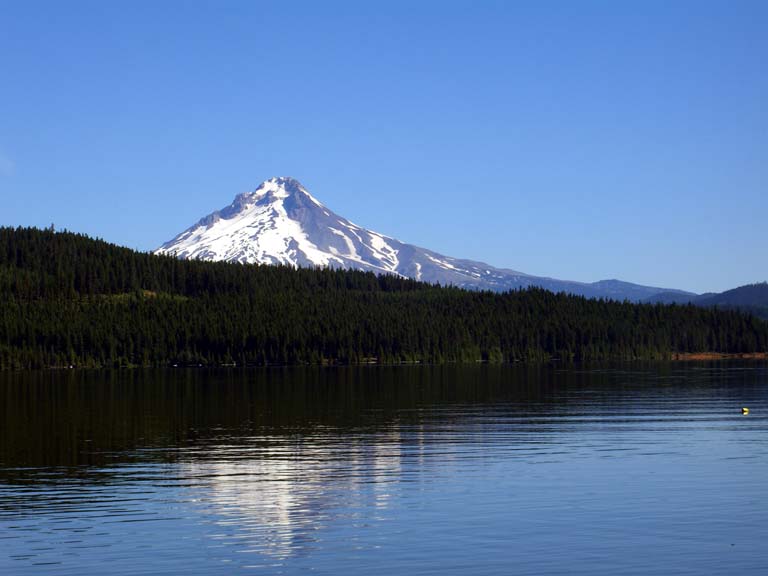
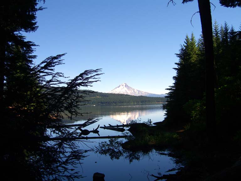 and pretty when the postcard quality scenery wasn’t interrupted by the dreaded car campgrounds. With two nights under our belts, we decided we were true veteran long distance backpackers (I’m sure actual thru-hikers are laughing here) and were obligated to look down on the car campers with their huge tents, boats, beer, real, food, chairs, tables, and the oh so comfortable air mattresses.
We continued on, passing more views of Mount Hood before we came to the junction we
 needed to take to head south to the Historic Clackamas Ranger Station we were intending to visit. Arriving there, just as my water ran out, we were pleased to see it open and better yet, cool and with empty chairs waiting for us. We sat and ate while chatting with the volunteers. I recommend visiting if you are in the area. Best yet, there was a nearby spigot coming from a well so we filled up with water, taking pleasure in not needing to filter the water. We showed off some of our equipment to another couple who had also been touring the historic station.
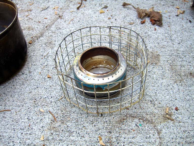
Since we knew that our camp site that night would almost certainly be a dry camp, we both stocked up on a lot of water, this time by necessity, unlike yesterday’s foolishness. I did take the opportunity to get rid of some extra fuel. When doing the planning, I had calculated that between the two of us we would probably need about a half of a liter of fuel (denatured alcohol). Not knowing how well my homemade Pepsi and Guinness can stove would really perform out in the wild, I made up three half liter bottles of fuel, one of which I had given to Karen. After two nights on the trail, we knew that the half liter calculation looked about right so I ditched one of my bottles along with some trash that we had been collecting along the way.
We left the ranger station and headed up the road to get back to the PCT and take
 photos under the PCT archway. We then headed southeast on the PCT which climbed towards the Warm Springs Indian Reservation. The reservation made for a bit of a change in scenery as there are numerous logging roads and clear cuts along the way. They don’t seem to log quite up to the trail, but they get pretty close in places.
Tonight we had no definitive plan for a campsite. Ideally we’d go to the Warm Springs River, or at least to a spring just north of it, but that would be a 15 mile day, something neither of us was anxious to do. The other consideration was the next night’s campsite: our plan was to camp at Lemiti Creek, the water source after Warm Springs river, which is 10 miles from the river. So we planned to go as far as we felt comfortable going and then find a place to camp along the trail. We quickly discovered though that other than the established campsites, there was a dearth of places for a makeshift campsite. We plodded along as the trail kept going up in elevation. Finally after 10 miles of hiking we took a break and decided we’d didn’t want to stop yet (which would make the next day a 16 mile day) but that we didn’t have the energy to make it the five miles to the river. Thus, we’d try for another couple of miles and hope to then find a suitable spot to make camp. But as soon as that plan was made, we stood up and took less than ten steps down the trail when we saw a cleared area with a fire ring. It was too perfect to pass by so we made camp.
This particular campsite was along an old jeep road. It was obvious that there was enough blowdown across the road going westward that no one would be driving up it from that direction but I walked it in the eastward direction to make sure no one would be coming from that direction either. Karen had been secretly packing a blowup flamingo and a feather boa and while
 I was out making sure that no jeeps would be running over us in the night, she was setting up Camp Flamingo. I ascertained that blowdown in the other direction was sufficient to protect us. I found some cut logs from a recent clearcut which were of a perfect size and height for tables. I also spied a heart shaped rock and knowing Karen collects them, I brought it back to camp along with the "tables." I thought it would be fun to give Karen the quandary of having to decide whether to carry the gift of the heavy rock or not. She claims that she meant to pack it but it somehow managed to leave her pack.
We had a nice dinner and were enjoying what we thought was our most remote and isolated campsite yet. The weather was clear and warm so we left our rainflies off the tents and retired to rest up for tomorrow's long day. Living out in Vernonia with its lack of light pollution, we regularly get to see the stars and milky way at night quite well. Despite that, I forced myself to stay awake long enough to see them come out that night – after all, with my mostly mesh tent and the rainfly down, I was going to be sleeping under the stars and I wanted to see them even if it was just for a minute or two. Satisfied with the first three or four stars that appeared, I went to sleep.
posted by James Cradit @ 2:41 PM
![]()

0 Comments:
Post a Comment
<< Home