James Cradit

Sunday, July 20, 2008

PCT Letterbox

From Wapinitia Pass head north on the PCT. You will soon come to an intersection with a trail to the Twin Lakes. Continue on the PCT for about 1/2 mile until you reach the part of the trail shown in the photo. Note that the arching tree may not last so don't focus only on it. At the base of one of the big trees on the left side of the trail you'll find a flat white rock with some moss on it. The letterbox is hidden under the rock.

Wednesday, December 19, 2007

Day 7: Back to Two Pan: 4.5 miles

We reluctantly got out of our tents as it was still really cold - one downside of camping deep in a narrow canyon where it takes a while for the sun to reach. We ate quickly and packed up and headed back to the Two Pan trailhead. The day was pretty uneventful. We did pass several folks who looked really strange to me. I finally figured out that it was because they were clean!

At Two Pan we loaded up the car and started back towards civilization but not before hiding one more letterbox in honor of the French Rabbit. We drove on, found a few letterboxes and most improtantly some showers and then camped at an RV park on the Columbia river in Boardman on nice lush and cushy grass.

Day 6: Copper and Elkhorn Creeks: 9 miles

We got up and packed camp again and headed up the Copper Creek trail. Shortly up the trail we found a nice campsite and while deciding whether to use it a father and two sons came by. They had spent the night before at the campsite and talked with us while we set up camp. They had left in place beds from pine boughs they had made (illegally!) for their tents and thought we were both a strange for not using them. They headed on down the trail and we headed up.


This part of the wilderness was very nice even if not quite as scenic as the Lakes Basin. It consisted of following Copper and the Elkhorn Creek. There would be periodic short rocky climbs in between meadows. Eventually we came to the highest part of the trail where we had the option of hiking down to Swamp Lake. It looked interesting, but neither of us was thrilled with the idea of hiking back up. So we headed down a little way on a different trail just until we could get a good view of the Minam river drainage.


Then it was back down the way we came to our campsite where we had cold showers as I had choosen a poor location for the water bladders.

We decided to play a game of scrabble and it quickly started getting really cold. We put on all our clothes and were still cold. We decided we had to either build a fire or go to bed and we choose the latter.

This was my coldest night ever backpacking. It got down to around freezing. For the first time ever I cinched up my sleeping bag over my face. I was then able to stay warm. Karen would later dub the campsite Camp Witchitit, which I understand is Nez Perce for really cold.

Day 5: Over Ivan Carper: 9.5 miles

All good things must come to an end. Today we would leave the primo campsite. Not only that, but we'd have to pack camp. And carry our full pack. Up almost 1000 feet over Ivan Carper Pass. But it was time to move on and so we did.

For the last time we went back by Mirror Lake and Upper Lake and then started the ascent to the top of the pass. It wasn't too bad. We got to the top and took a break. While sitting there we heard someone coming up from the other side. We greeted him and he ignored us, dropped his pack and headed back down. Several minutes later he reappeared with another pack and shortly after that his wife came along. Despite the earlier snub, they turned out to be friendly and we chatted for quite a while.

Eventually it was time to move on and we headed down into the west Lostine River valley. Along the way we met a woman on a horse who thankfully turned out to be quite friendly. We told the story of my earlier run in and she had a laugh and said if the horse was really that skittish it had no business being out on the trails. Karen had done a llama trek in the Wallowas several years back and the woman knew the tour operator and updated Karen on her and the llamas.


Further down the trail we ran into some young guys coming up the trail. They looked to be fit but one of them was obviously struggling to get up the hill. It made me feel good to know I was in better shape than him!

We quickly came to Minam Lake where we dropped our packs. Minam Lake was once the headwaters of the Minam River but once upon a time the locals decided they wanted the water to go north instead of south. So they built up the south end of the lake until it spilled over to feed the Lostine River. A bit of the water still seeps out to feed the Minam and we walked over the dike where it does that to head up to Blue Lake which is now the headwaters for the Minam.

We stayed at Blue Lake for a bit and then headed back down. Along the way we saw a mama blue grouse and several chicks. We watched them for quite a while as it took took them 20 minutes to cross the trail. They didn't seem too shy, which probably explains why they are endangered. Back down at Minam, we saw another family of grouse, this time including papa.


We picked up our packs and headed down the West Lostine Trail. We had a couple of difficult river crossings but managed to get across without getting wet. At Copper Creek we found a nice meadow with some nearby campsites. We set up camp and headed to the creek to wash up and filter water. There we saw some folks camping in the meadow (which is illegal). One of the guys wandered over and asked us if we knew of a lake nearby that started with an M. We told him Minam Lake was about three miles up the trail. He asked how to get there which was odd since they had to have walked by a hugh cairn with a sign in it pointing out the direction to the lake to get to where they were. We offered to showed him our maps and he said he had one. Apparently he hadn't bothered to look at it.

Day 4: Eagle Cap: 6.5 miles


It was the day to summit Eagle Cap. Eagle Cap is, not surprisingly, the highlight of the Eagle Cap Wilderness. It isn’t the tallest peak (Sacajawea Peak and the Matterhorn are both about 250 feet higher) but it is the central peak with eight valleys radiating in all directions from it and features a 360 degree view. We headed once again towards Mirror Lake. Along the way we met some folks who let us know about the helicopter. It seems that there was a fire which started at one of the campsites. The story was that some people reported showing up at a campsite and seeing a fire smoldering when they got there. They thought they put it out but it flared up again. Fortunately, the forest ranger was nearby and he and other campers in the area started a bucket brigade to put it out. The fire was built right next to a log and apparently got quite big before they got it put out. Fires are generally allowed in the Eagle Cap Wilderness but not within a quarter mile of the most popular lakes so someone not only built an illegal fire, they also built it near a dry log and didn’t make sure it was out.

We headed further down the trail past the turn off for the East Lostine Trail and onward to the junction for Horton Pass and Eagle Cap. We passed Upper Lake, not surprisingly, the highest lake in the Lakes Basin. It is the headwaters of the East Lostine River. From Upper Lake it is about a 25% grade up to Eagle Cap so we were glad to be day packing again. The day was nice and we were running into quite a few people also on the way up. We rested a while and talked to some folks at a trail junction with a choice for Horton Pass or the Eagle Cap summit. We met some folks there and told them about our campsite. They were jealous but we kept the location secret. We would run into them several times going up to the summit. Eventually we talked about having wine and they told us they had Jack Daniels with them. Deciding they were cool enough, we gave them directions to our campsite if they wanted to join us.

At the summit there a crowd was lounging around enjoying the view. It was incredible. We identifed the lakes in the Lakes Basin and we took untold number of pictures. We spied our campsite with Karen’s binoculars – it was tough to find it, without my orange rain fly we probably wouldn’t have been able to. One side of the summit looked almost straight down into Glacier Lake. The view down the East Lostine Valley was incredible; pictures don’t do it justice. It seemed we had just gotten to the top when I looked down at my watch and noticed that an hour had gone by!

We discovered that the summit log was missing so we weren’t sure what to do with the letterbox. We spied around to see if anyone up to might have a container we could beg from them but we didn’t see anything suitable. We eventually decided to just hide it in baggies and hope for the best.
We took a slightly different and longer route down to visit Horton Pass. As we were heading down to the pass I spotted a bighorn sheep on the slope below us. I excitedly pointed it out to Karen but then saw some people on the trail near it and decided that it must be their pack animal and said, “It’s just a donkey.” Karen laughed at me since 1) I should have said mule and 2) it was indeed a bighorn sheep. She though started calling it a bighorn goat and since then we’ve renamed them “donkey goats.” We watched it for quite a while – and it was keeping an eye on us. We took pictures, even trying to take some though the binoculars which turns out to work quite well other than it being really difficult to aim the camera. I got some great close ups of some rocks! We eventually started to continue down the trail getting closer and closer to him. Eventually he headed up hill straight towards the ridge we were descending. We lost sight of him and continued down the ridge. Eventually we came around a tree and saw him right in front of us! We quickly jumped back behind the tree. I didn’t think he would actually charge but I knew that they butt heads at 20 miles per hour and didn’t want to risk the chance of finding out what that feels like. We gave him plenty of time to move on before slowly peaking out to find that he was gone.

We continued down to Horton Pass, which is fairly non-descript but does have a plaque commemorating the elephant who heard the Hoo in the Dr. Seuss book. Not really – it commemorates Floyd Vernon “Jack” Horton a forester who apparently made many contributions to the development of the Wallowa-Whitman and other national forests in the Pacific Northwest. We then headed back to camp.

Day 3: Lakes Basin Day Hike: 8.0 miles

We woke up to a beautiful day with no sign of smoke. We made breakfast and as I was exploring the vicinity I found a nice sized hole in the ground. It was out in the open but out of sight from our tents and just the right size and depth for a latrine. Another feature in our fabulous four star campground! We had breakfast and headed out for a loop tour of the lakes basin. As we were planning to stay in place multiple nights, we took off with just some water, snacks, and first aid in our packs. We also left some water out in a bladder on top of my black rain pants so we could have warm water to bathe with when we got back. We headed out to the trail in a different direction from where we came in in the hopes of finding a better way. We didn’t find a particularly direct route, but it was pretty close.

We headed clockwise on our loop and soon came to Crescent Lake, a pretty lake with a cute little island you can wade to in it. We lollygagged for a while enjoying the water and watching the clouds. Eventually we headed on, past Douglas Lake and little Craig Lake. We looped around Douglas Lake and in view of Moccasin Lake, we looked for an unofficial trail to Pocket Lake. We eventually found it and headed in search of yet another lake. The trail was easy to follow for quite a while until it came to a meadow. We searched for its continuation and found several trails all of which eventually petered out. Eventually we decided to give up and we turned back. We walked along Moccasin Lake and then came upon the east end of Mirror Lake where took the trail back up towards our campsite. We ran into a few of the folks from the big family was saw at Two Pan. They had camped above Mirror Lake and were heading to camp at the east end of the Lakes Basin so we knew we wouldn’t be running into them anymore.


We tried yet another way to the campsite and found a pretty good way in. Back in camp we found yet another feature of the campsite – there was a rock at just the right height to place the water bladder for a shower and there was even a small ledge the perfect size and height for a soap dish! We washed up and got the wine out. I was really starting to like this set up! I gave Karen my letterbox clues and she went to look for it. When I heard a howl of laughter, I knew she had found it as the stamp was just so appropriate for the letterbox. I hadn’t even carved it for this adventure – I had carved it years before for a different place and then decided not to use it. I stumbled on it shortly before the trip and realized it was perfect for a backpacking adventure. If you want to know what the stamp is, you’ll have to make the journey yourself.

We ate dinner and then settled down to making a letterbox. We weren’t fully prepared, but we decided we had to leave something on the top of Eagle Cap. We both carved part of the stamp and decided that baggies would be enough as our plan was to leave it in the summit log box. Soon we heard a helicopter. It flew almost directly over us. Our forest fire fears returned. We couldn’t tell if it was a fire helicopter or not but we stood and listened for awhile. Eventually it went away and didn’t return so we felt safe enough to go to bed.

Day 2: Two Pan to Lakes Basin: 8.0 miles

The morning brought our last real meal compliments again from Don and Gwen and then we said our goodbyes. Karen and I headed out and took a long slow dusty drive down the Lostine River Road to Two Pan Campground (elev. 5600 ft) which is really less of a campground and more of a parking lot and staging area for the hikers and equestrians heading into the Eagle Cap Wilderness. There was a large group of folks getting ready too who all were packing the same green sleeping pad. We found out that they were an extended family out for their yearly backpacking trip. There were a couple dozen of them so we were hoping that they wouldn’t be camping near us. Several months earlier Karen had gotten some info on a primo campsite off trail complete with a granite table. We had some vague directions to it which consisted entirely of a low resolution topo map with a circle on it. It was a little bit away from the Mirror Lake, the most popular place to camp, so we weren’t too worried about camping near the crowd, assuming we could find the secret spot.


We headed up the East Lostine Trail which starts out fairly steep gaining about 1500 feet in about 2.5 miles. In this section we stopped so Karen could hide a letterbox and I could get yelled at by a grumpy old woman on a horse. While I was sitting on the side of they trail waiting for Karen, the woman and two others on horses came up. She yelled at me to move our packs off the trail – they were resting along the edge of a six foot wide trail. I moved them and sat back down. She then yelled at me to move our poles, which weren’t even on the trail. Apparently she had the most skittish horse in the world. I’m not sure what she did when there was a stick on the trail. Perhaps she yelled at Mother Nature to move it.

With the horses gone and the letterbox hidden, we finished the climb up to a marvelous three mile stroll through the meadows of the East Lostine River Valley. The valley in this portion has the classic U-shape of a glacial carved valley and better yet is very flat! Soon enough though, the trail leaves the meadows and climbs up the valley walls to the Lakes Basin. This basin is the home of an abundance of lakes both large and small. The first we came to was Mirror Lake. We walked along it spotting a few tents here and there. We were a bit tired but continued on though intent on finding the secret campsite. We headed north past Sunshine Lake and spotted a faint trail which headed generally towards where we expected the secret spot to be. We followed it for a while and it petered out. We navigated mostly by feel until we came to a cliff overlooking Moccasin Lake. Using this as a data point we headed generally north. The terrain was rocky, but not too rough. Our topo maps were of minimal use since the contours were 40 feet apart and the area was rampant with 20 - 30 foot outcroppings. We were getting a little grumpy. It isn’t much fun carrying around 35 pounds of weight on your back when you aren’t exactly sure where you are going.

Eventually we spotted a small lake. Our campsite (elev: 7800 ft) was supposed to between two small lakes so our spirits were lifted a bit. The problem was that the lake was 30 feet below us. Straight down. We tried traversing around but soon ran into a deadend unless we wanted to try going further on a foot wide ledge. Instead we wisely hiked away from the lake looking for another way around. We lost sight of the lake, but found a way up and over and spotted the other lake! We were close. Now all there was left was to find the table. I dropped my pack and went on ahead and soon spotted the table! I ran back singing “table, table, table” and dancing a silly dance – all of which I’m quite happy wasn’t captured on video.

The table was a giant slab of granite, about three by five feet and 6 inches thick resting on cut logs. There were even four more cut logs for chairs. In addition to the table, the camp had a nice view of Eagle Cap and the Matterhorn and was no where near the trail – what more could you ask for?! We set up camp and broke out some wine. Yes wine. Karen had a few months earlier discovered some French wine that came in liter boxes (http://www.frenchrabbit.com/) and we both brought some of that along. I also brought a half liter box of Vendange wine.

After dinner, I hid my letterbox and then we were treated to an incredible sunset. We took tons of pictures of both the Matterhorn and Eagle Cap. We did have a bit of a scare when we could smell some smoke. We knew that there were forest fires in the vicinity. The big one was over in the Hell’s Canyon area and wasn’t of much concern. There was another one to our southwest but it was supposed to be contained and wasn’t particularly close either. But it is always a possibility for another one to start. We figured that the smoke was just being carried by the winds from the Hell’s Canyon fire and that it was actually a bit of a blessing in that it probably helped make the sunset more spectacular.

Day 1: Drive to Wallowa County: 0 + 2.0 miles

Sunday morning I woke up early to drive to Portland to pick up Karen and begin our drive to the Wallowa Mountains. From Karen’s house, the drive was mostly on I-84. The drive was mostly uneventful, though at one point I saw some bighorn sheep on the side of the highway. I tried to point them out to Karen but she missed them. I have since learned that they are around that area quite often and the government has plans to relocate them as they are deemed a hazard as they tend to distract drivers on the highway. We stopped in Pendleton for lunch and then went to replace one of Karen’s letterboxes. Being in Pendleton, we had to also make a stop at the Pendleton Mill Store. Karen bought her umpteenth blanket, I managed to resist. From there we headed up to Deadman Pass where we made a quick stop for a letterbox and then over to La Grande. There we stopped at Wal-mart so I could buy some rain pants as our insurance policy against bad weather.

From La Grande, we left the interstate to begin the journey up into the Wallowa valley. Along the way we stopped for one letterbox and at the Terminal Gravity Brewery for a quick beer. From there we headed further down the road to the Mountain View RV Park where we met up with Don and Gwen, some letterboxers from California. They seemed perplexed when we drove up. When we got out, they wanted to know why we showed up on Saturday when we had planned to meet them on Sunday. I thought they were trying to be funny but soon enough we realized that they had actually lost track of the days and really though we were early. But they managed to whip up a delicious dinner while Karen and I set up our tents. Kwene B, a local letterboxer joined us later and we all took a drive to Wallowa Lake to find some letterboxes in the dwindling light.

Sunday, September 03, 2006

Tenas Camp to Washington

Day7, Tenas Camp to Washington: 10.5 + .5 miles

We woke up and fairly quickly ate and packed: we had almost seven miles to Charburger and we wanted to be there! Down at this stretch of the trail there were quite a few day hikers and we were seeing groups of them that numbered more than all the people we’d normally see in one whole day. Stymied in our attempt at a letterbox near the trailhead we headed on to the Gorge trail, a pretty but loud (from the interstate) trail which is a 12.8 mile long trail from Bridal Veil to Ainsworth State Park. It is also the trail from Eagle Creek to Cascade Locks. A portion of the trail is paved for bicycles and splits at one point. We followed the paved portion to the northside of the freeway and were rewarded with comparative silence as we were well below the highway. Soon we reached the end of the trail, conveniently located at the Charburger parking lot. We went in and enjoyed the view of the river and the Bridge of the Gods while eating our huckleberry pie and hamburgers. Yum! Being right there we decided that we couldn’t pass up the opportunity to hike across to Washington. There we read a visitors kiosk and dreamed for the hot springs in Carson and learned about the landslide which had temporarily blocked the flow of the Columbia and became the Indian bridge of the gods! Heading back Karen spied a pioneer grave just beside the park and ride lot. We paid our respects and then headed back to Oregon.

We hiked back on the Gorge trail the whole way and at one point switched back up a hill and thought we were experiencing a PUD until we found a nice view of the remnants of the landslide. Back at Eagle Creek we ditched our packs with the camp host and went to find one last letterbox. On the return, I suddenly felt tired and done. I think my body knew this was the end and was shutting down. So I found a nice grassy area and laid down awaiting for Keith to pick us up. The hike was done. We'd backpacked from Timberline Lodge to Washington, 56.5 miles with our packs plus another 11.4 without!

Wahtum Lake to Tenas Camp

Day 6, Wahtum Lake to Tenas Camp (Eagle Creek): 9.2 miles

Ryan didn’t join us during the night so we headed out without him. We didn’t have a specific camp site in mind along Eagle Creek but we expected that Ryan would catch up with us and if not he’d just check all of the campsites as he passed them. The hike was all downhill from here, literally!

Along the way we crossed several creeks including the Indian Springs Fork of Eagle Creek, fed by that elusive Indian Springs. We had seen an older couple back at Wahtum Lake who were hiking from Palm Springs to Cascade Locks and they had found the springs and told us where it was. Oh well, it was nice to have two nights in one spot so everything worked out OK anyway.

One of the features of the Eagle Creek trail is the abundance of waterfalls. Most hikers stop at Tunnel Falls, if they even get that far, but there are several unnamed but very pretty falls further upstream. As we hiked we ran into a couple of guys who had just moved to Portland out for a weekend backpack trip. We also met a college aged boy backpacking alone. I nicknamed him “Right on!” because he must have said that 20 times in our conversation with him. Karen kept calling him “Jose” though I’m not sure why as he wasn’t Hispanic looking at all.

We stopped just above some falls which are not officially named but commonly referred to as Crossover Falls. There are several pretty pools in the creek in this vicinity which look quite inviting but are a little too cold for swimming. We still enjoyed washing our feet and sunbathing on the warm rocks. In no hurry to get to camp and hoping that Ryan would wander by, we relaxed for a good hour. It was quite serene even though we were only about 7 miles from interstate 84. The only person we saw was a girl and her dog doing an overnight trip. She was hiking in flip flops (she did have boots hanging from her pack) which seemed like a bad idea, especially as much of the Eagle Creek trail is quite rough from being blasted from the basalt canyon walls. As the canyon walls were beginning to bring shade we headed down the trail to stunning but acrophobic Tunnel Falls. Here the trail makers actually blasted a tunnel through the cliff behind the waterfall! It was here that we began to run occasionally into day hikers. Onward Karen found a letterbox I had hidden last year and then I found one of hers. As I was packing up the letterbox, I discovered that I had lost my datasheet! Since we had only to head down the Eagle Creek trail, a trail we were both familiar with, it wasn’t a disaster, though it was still like losing a friend. We were then debating which campsite to stay at when Ryan came down the trail – with my datasheet! Reunited we quickly decided to camp at the campsite closest to the trailhead – and more importantly, closest to the Charburger in Cascade Locks.

So we headed down to Tenas Camp which is a mere 4 miles from the trailhead. The abundance of toilet paper testified to it popularity though being a weeknight we had the site to ourselves. Here I found a bad science fiction book someone had left behind. We caught up on the adventures since we separated. Ryan had lost his food bag and half his tarp to a bear. Even though Karen and I only brought half the food this time, we still had plently to share. Then, with mixed emotions about it being our last night, we went to bed.

Saturday, September 02, 2006

Wahtum Lake

Day 5, Wahtum Lake: 0 + 7.5 miles

What a joy it was to not have to pack camp! Ryan still did as he didn’t know if he’d finish his loop or not. If not, he’d camp somewhere and meet us the next day. Ryan left us and soon Karen and I were on our way for a day hike carrying only water, some snacks, and some minimal gear like cameras and first aid. We headed towards the car campground which is reached by a nasty set of steep stairs. Up there we saw a few car campers and I was glad our hike-in site was a good stroll from there.

We headed up the Anthill trail to a junction with the Herman Creek trail which Ryan was taking. Our plan though was to leave the main trails and hike up to Tomlike Mountain.

There is something of a trail to Tomlike Mt. but it is a user trail and not official thus is a little hard to follow, especially through some rocky areas. It is easy to see where you need to go so the trail isn’t really that important. This turned out to really be a highlight of the trip. The views, though hampered by the haze from the forest fire, were spectacular. This hike is on my list to do again on a clear day.

The wildflowers were in bloom and there was a cute little forest of some pine trees struggling for survival on the open rocky ridge. I expected to see a hobbit or gnome at any minute.

At the summit we relaxed for a while near what is either a windbreak built out of rocks or possibly even a native American vision quest pit and enjoyed watching birds
riding the thermal currents. On a lark, I tried my cell phone. It showed no coverage but I dialed anyway and Penny answered! I was glad to be able to report that I was alive; I think I got a little grumpy towards the end of the first segment as I was worried about Penny being worried about me. Karen then tried to call Keith but the phone would no longer work!

We headed back to the Herman Creek trail and took it back to the PCT which we followed to the Chinidere Mt. trail, a short but steep series of switchbacks to the summit. There were many of the windbreaks/vision quest pits at the summit here too and the view included Wahtum Lake and Tomlike Mt.

We headed back to camp via the steep PCT shortcut trail. Back in camp we had literally hours to waste before dark so we finished up the tequila, played a game of scrabble, and took pictures of my blisters. The fourth toe wasn’t as bad as it looks in the picture; the dirty blister bandage was still on it.

Then we decided to build an actual campfire which had us craving fire baked potatoes. This was our first campfire on either segment (except for at Olallie Lake which doesn’t really count). We both had fun playing with the fire and sang kids songs. I hope no one was around to hear our little concert; there certainly was no standing ovation when it was over. Finally we went to bed to cap off a most enjoyable and relaxing day.

Lost Lake to Wahtum Lake

Day 4, Lost Lake to Wahtum Lake: 13.4 miles

The time at Lost Lake must have been refreshing as the trek back up the Huckleberry Mountain trail didn’t seem bad at all. We continued our journey down the PCT and soon met up with some hikers coming the other direction. They said that they had seen someone illegally camping under a tarp just off the trail a mile or so back. We hurried up the trail assuming the scofflaw was Ryan. It was. We got there just in time to see him getting a ticket from a Ranger for illegally camping in the Bull Run Watershed. It looks like he will be fined separately both for camping, having a campfire, and for not properly storing his food so his fine will be $15,000! Look for the AtlasQuest premium membership prices being raised to $100 a month soon. With so many people addicted to AQ, I expect Ryan will shortly be turning a profit from his little run in with the law.

Reunited we got back to hiking, our goal was Indian Spring campground which would make something like an eleven mile day. After getting to camp with about a liter of two of water each day so far, I decided to carry less weight this day. Pretty soon we reach the side trail for Buck Peak, Buck referring not to native Americans or wildlife but the dress code. Ryan, apparently quite modest, refused to follow the dress code but Karen and I made the trek to the top, which was well worth it not just for the view but also the abundance of big, juicy huckleberries.

Continuing on, we were looking for the end of the Bull Run Watershed which would mean we were about four miles from Indian Springs. We went a long way without seeing the end and I assumed that we had either missed the sign or that it just wasn’t well marked. The next waypoint was a crossing of the old Larch Mountain road, two miles from Indian Springs. We finally saw a sign and it indicated the end of the water shed! I calculated that we had been hiking only around 1 mile an hour. Even accounting for breaks, that seemed really slow. We were pretty disheartened. Shortly though we crossed the road and we recalled that while the sign indicated the trail was 11 miles on the watershed, our maps indicated only 9 miles. Apparently the guy in charge of putting up the sign was a lazy bum and didn’t want to hike the two miles from the road to put it at the right place. We soon left the forest and began traversing the side of Indian mountain with its incredible views of the foothills of Mt. Hood. It is quite amazing to see the vast forests and hills there are between Mt. Hood and the gorge. We were able to identify the Eagle Creek canyon and spotted Mt. Adams and Mt. St. Helens. Soon we spied Ryan sitting against a cairn with his umbrella and Mt. Adams in the distance. You could also just make out Mt. Rainier. We were just minutes from the campground and I took the last sip of my water. I had finally carried the optimal amount of water! At the campground we looked for the spring. And looked. And looked. We found several dry creek beds but no water! Karen was out of water too and Ryan just had a little left. The next known water would be at Wahtum Lake, another 2.6 miles away with no water to sip along the way. With the daylight rapidly waning, we didn’t have the luxury of looking for the spring anymore so we headed down the trail. Ryan went out front, I stayed with Karen who impressed me with her hiking speed: she even did a little trail running at times. A one point we stopped to take our water bladders out to get the last few drops of water out. We each got a very welcome swallow of water. We hiked on and Karen said she could smell water. I thought I could too and then Ryan came up the trail with water and wet bandanas for us. It turned out we were just around the corner from the lake. Ryan hadn’t expected us to be so close behind him. We still appreciated the effort by Ryan!

We made camp and Karen pulled out her last surprise: tequila shots – complete with salt and lime! Ryan doesn’t normally drink so just the half of a shot he did was enough to get him happy enough to reenact his crotch fire incident from the AT. We discussed the next day. The previous plan was that we’d just hike from Indian Springs to Wahtum lake for an easy day and then do some day hiking at the Lake. Now that we were already at the lake, Karen and I decided to just stay two nights at Camp Double Time. Day hike weren’t challenging enough for Ryan so he hatched an idea to hike to the Benson Plateau and back.

Thursday, August 31, 2006

Muddy Fork to Lost Lake

Day 3, Muddy Fork to Lost Lake: 11.8 + 3.4 miles

The morning came and we found that another of the Janes had left the group (leaving just the one who seemed to have a thing for Ryan). We figured she’d hang on a little longer. We broke camp and headed up a dry and rocky creek bed towards the river crossing. It wasn’t really any less scary in the morning. Ryan had to be manly so he boldly leaped from rock to rock and crossed quickly while I was more gallant and carefully carried Karen across the river. Safely on the other side we found more rocky scrambling to be done and then found a steep bank of loose scree down to an even more raging river. This time Ryan let me carry Karen across first. I assume he did this so that he could see how I picked my path. I managed to get across without Karen or our packs getting wet though I was pretty soaked up to the waist. Ryan came behind and we were all thankful to be done with all the hazardous crossings on our route.

We climbed up out of the valley towards Bald Mountain. We continued to get great views of Mt. Hood though the air was pretty hazy from the smoke blowing over from the forest fire on the east side of the mountain. We had been hoping to take the Timberline Trail up to McNeil point to do some letterboxing and then camp at Lolo Pass. This would work out well as it would have us camping just north of the Bull Run Watershed where no camping is allowed for a nine mile stretch of the PCT. But we found the trail closed for the fire. We had anticipated this possibility from the last report we had but we hoped to go up the trail anyway. An armed kid wearing a National Guard uniform at the trail intersection spoiled that plan. We didn’t really have a plan B: stopping at Lolo Pass would make for a shorter day than we wanted and the next known campsite would make for an 18+ mile day.

We walked on pondering our plan. Our options were basically taking the risk of stealth camping in the watershed or hiking down to Lost Lake. Ryan had never been to Lost Lake and asked if there was a store there. We told him yes. He then mentioned the possibility of ice cream and the plan was decided on! We headed onward and soon began to meet day hikers, most of whom were planning on going to McNeil point. With tears in our eyes, we regretfully informed them that their plans were shot.

Soon we started the steep descent to Lolo Pass, losing about 800 feet of altitude in a little over a mile; altitude that we’d just have to regain on the other side. A little depressing, though at least it wasn’t a PUD (PUD is “AT” talk for pointless up and down) since there is no flat way the trail could have gone. This is the part of the trail where I got my blisters. I had managed to go the whole time on the Barlow to Olallie hike without so much as a hot spot so I guess it was my time. I think what brought it on was that the downhill grade was making my feet slide forward in my shoes which compressed my dirty and wet toes together. It put some moleskin on but it was apparently too late.

We headed up towards Bull Run and soon began to see the signs informing us that the penalty for doing just about anything in the watershed was up to $5000 and 6 months in jail. The signs didn’t specifically prohibit peeing into the watershed so at my first opportunity to pee on the west side of the ridge we were hiking along, I did so. Don’t get too revolted, urine is sterile after all!

I don’t think that I’ve mentioned that Ryan didn’t usually hike with Karen and me. Instead he’d hike out in front of us and then stop and rest while waiting for us to catch up. This generally worked out ok, though when we got to the junction with the Huckleberry Mountain trail which descended to Lost Lake, we were surprised to not see Ryan waiting for us. We figured that he had gone ahead down the trail so we headed downwards.

It was good that we were just two miles to the lake, but the downward grade was hell on my blisters. The last mile seemed like an eternity to me. We finally got down near the end of the trail and found some really nice campsites available. Some folks at one of them informed us that these were the overflow spots and were legal and free! We had yet to find Ryan but with such a good spot, we made camp. I changed into my Crocs practically before I even took my pack off which felt even better than it normally does. Karen kept her boots on, as we were planning to walk the 3.4 miles around the lake to go to the store and to hunt a letterbox and possibly find Ryan. But my feet were done with my shoes for the day and I kept the crocs on. We hit the trail and stopped at the lake which was quite refreshing and then headed to the store. I got ice cream and a beer, which actually goes together much better than you’d think. We watched the idiots who were renting the apartment over the store. One guy was dousing a lit grill with lighter fluid and then he piled about 30 potatoes in a pyramid on the grate which was raised as high as it could go above the fire. I suspect some of those potatoes are still raw.

Leaving the store, we continued around the lake to see the incredible view of Mt. Hood across the lake. There was still a smoke haze though that didn’t keep the view from being incredible. For us, it was even more so as we knew that we had hiked from the mountain. We headed on and found the letterbox and returned to camp. Since the lake was the first water we had met that wasn’t ice cold, we took the opportunity to bathe and do some laundry. We stayed pretty modest though that didn’t stop a bunch of high school kids from spying on us. I’m not sure who – or what – they were hoping to see, but I suspect they went away disappointed.

We went back to Camp Mirage and ate dinner. We wondered about Ryan but figured he must have somehow missed the side trail and that we’d catch up with him the next day. Tired after our longest day, we went to bed.

Sunday, August 27, 2006

Paradise Park to Muddy Fork

Day 2, Paradise Park to Muddy Fork: 7.5 miles

Shortly after we went to bed, the wind kicked up. It was swirling and loud. The temperature was in the mid-fifties but with the wind chill I wished that I had put up my rain fly. I slept fairly well and was awakened in the morning by the thru-hiker stomping through our area – it seems he was having trouble locating the continuation of the trail, which was odd as it was pretty obvious to me. Karen and I got up and started breakfast. I went to the creek to get more water and saw Ryan still asleep under his tarp. Well, actually I saw a collection of dust that looked something like a marble carving of a man in a sleeping bag. Ryan had set up his tarp to optimally collect the wind and volcanic dust. The campsite was officially dubbed Camp Dust Bowl.

Ryan finally got his lazy butt up and soon we were on the trail. We hiked through the rest of Paradise Park and soon rejoined the PCT. The plants along much of the trail were quite dust covered from the dust the wind had kicked up. We continued down into the Sandy River canyon which was the second crossing that was potentially hazardous. There were a couple of logs placed across the river so it wasn’t too bad. We stopped for a while to admire the butterflies. Soon a couple of men who had also been camping at Paradise Park came to the river. As the first was crossing he fell into the river and I valiantly rescued him.

The excitement over, we headed up the trail to a “confusing” trail junction. Karen and I went the correct way while someone who shall remain nameless went the other way. Karen and I soon got to the pretty Ramona falls, which, as it can be done as a day hike, was teeming with hikers. We took photos and went off in search for Ryan’s letterbox there. We found the box and headed back to the falls where we found Ryan reading his book. The group back intact we headed up the Timberline trail. I think it was somewhere around here that we lost one of the Janes. The funny thing about the Janes were that they weren't very talkative but when they did the occasional utterance, boy would it be foul!

Along the way we passed an older man with a younger girl who told us that there were some campsites this side of the Muddy Fork. They had started at Lolo pass and had camped there last night and would be doing so again before heading back to Lolo to complete their trip. We found the campsite and it was nice and near a clear creek so we decided to make camp there. Karen went down the trail away to scout the crossing of the Muddy Fork, which was the last of our potential hazardous crossings. She came back with a report that it was really scary. I decided to check it out too, and while it looked a little tricky, I didn’t think it would be that bad, especially in the morning when the level would be a little lower. We set up camp and et dinner and then headed down to a dry canyon to watch the mountain as the sun went down and to play scrabble. For those wondering why I keep saying “et” it is all a set up for the report on the scrabble game. I had already amassed an extremely large point lead over Karen in the game when I had the opportunity to play “zeal” on a triple word square. To play it though would also make an “et” on the board. I went ahead and played it and Karen challenged it. As a surprise, I had brought a scrabble dictionary with me and “et” was in it and defined as the past participle of “eat.” Karen was furious and had some choice words about the quality of the dictionary. But the play stood and I wound up beating Karen 392-34.

During the scrabble game, the older man and younger girl came to the canyon to watch the mountain too. They began to give each other back massages. Sexy massages. I would have taken pictures but the pictures would be illegal in most countries. The sun went down and we headed back to Camp Lololita. Lololita and the muddy old man started up a campfire and Karen stole the scrabble dictionary from me and took it over and threw it in their fire to end our second day.

Friday, August 25, 2006

Timberline Lodge to Paradise Park

Day 1, Timberline Lodge to Paradise Park: 4.1 miles

The time had finally arrived for segment two: Timberline Lodge to the Columbia River Gorge. The day started with snafus: The ATM at the Vernonia Sentry was broken and I forgot the second sheet of my filing papers for running for City Council that I needed to turn in before the journey. But Sharon worked her magic on the ATM and Joanne provided a copy of the filling paper that I quickly filled out. That done, Penny and I headed to Karen’s and we arrived just a little late. Ryan’s jalopy was parked out in front so I knew that it would be a threesome this time! As we were all raring to go we loaded up and hit the road.

For Penny’s sake I think we managed to mostly avoid letterboxing conversation during the drive but after the spaghetti sucking and sterile urine conversations I think Penny may have preferred us talking about letterboxing. In the rush to get out of the house I hadn’t eaten breakfast and was happy when Ryan suggested stopping somewhere along the way for lunch. So we stopped in Sandy where we all had burgers and met a lovely threesome of women all named Jane. The Janes were also apparently destined for Timberline and would wind up joining us for part of the journey. Well fed we hit the road again and went up to Timberline.

Soon we were met with a swarm of California Tortoise Shell Butterflies. As we later learned the butterflies periodically have population explosions that corresponds to their food source supply. Dodging butterflies we headed up the Timberline road to the lodge. In the parking lot we met a fine fellow named Ralph who wasn’t talkative but latched onto up group.

We ran the gauntlet of tourists as we threaded our way through the lodge and up to the second floor where we escaped and headed up the maze of trails to find the Timberline Trail, which is also the Pacific Crest Trail for several miles on the 
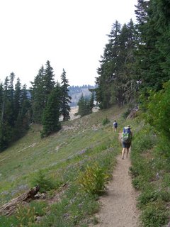
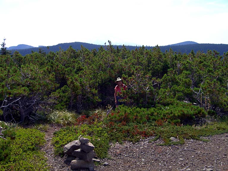
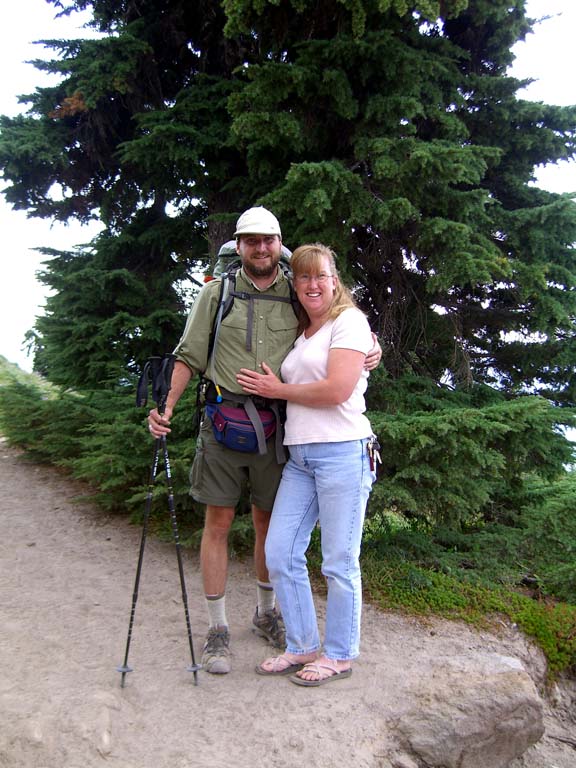
south and west sides of Mt. Hood. It was about here, while we were taking photos, that a group of 12 school children passed us. They were college students, and Ryan took bit of exception with me calling them children, but as he is just a wee child himself, that was to be expected. I figure that anyone less than half my age is a child. Penny decided to join us for a bit and we started the hike: Ryan, Karen, and I with our 30 – 35 pound packs and Penny carrying nothing and wearing flip flops. You decide who was the smart one in the crowd. Soon we came to our first water crossing. It wasn’t particularly big, we managed to cross in several jiffies but on the other side we noticed that Ralph was no longer with us (though the Janes were). Penny had seen him on the other side of the stream but he was now nowhere to be seen. We didn’t worry too much, figuring that he had headed back towards the lodge. He was a bit of a flighty fellow anyway.

We continued on and soon met the Little Zigzag Canyon. Penny decided that this would make a good place for her to turn around and after a hug or two, we said our goodbyes.

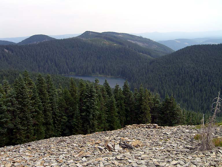
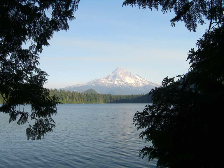
We soon reached the Zigzag Canyon and its viewpoint of the peak of Mt. Hood. While admiring the view, Ralph made an appearance! A strange one was this fellow: for the rest of the journey we keep running into him. We went down into the canyon and soon reached the Zigzag River, one of our potential hazardous crossings according to the map. It was pretty tame and we easily crossed. This was the point of the trail where the vast extent of the day hikers turn around (if they haven’t already) and we only saw backpackers for the rest of the day. At the top of the other side of the canyon we came to a trail junction where the children were resting. We were happy to see ripe huckleberries but there were very few left for us as the children had et most of them already.

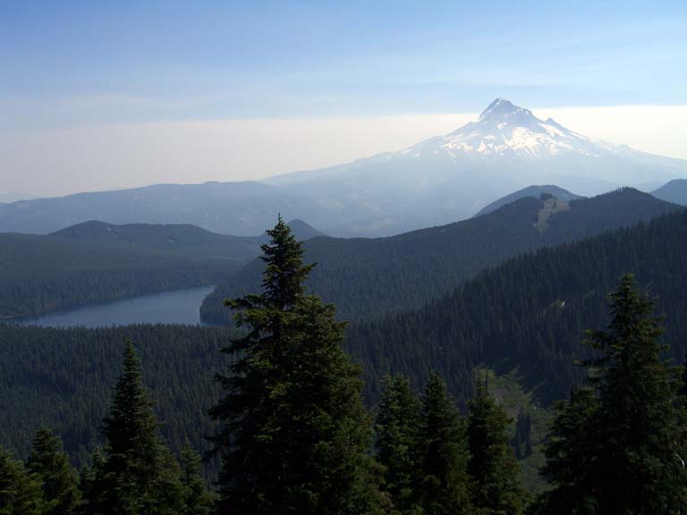
There were two trail choices to Paradise Park at this junction, we waited until the children were on their way and took the other trail. We walked through forest and wildflower meadows and soon rounded a bend in the trail and got our first glimpse of Paradise Park. Words, and even pictures, cannot do it justice. We enjoyed the 
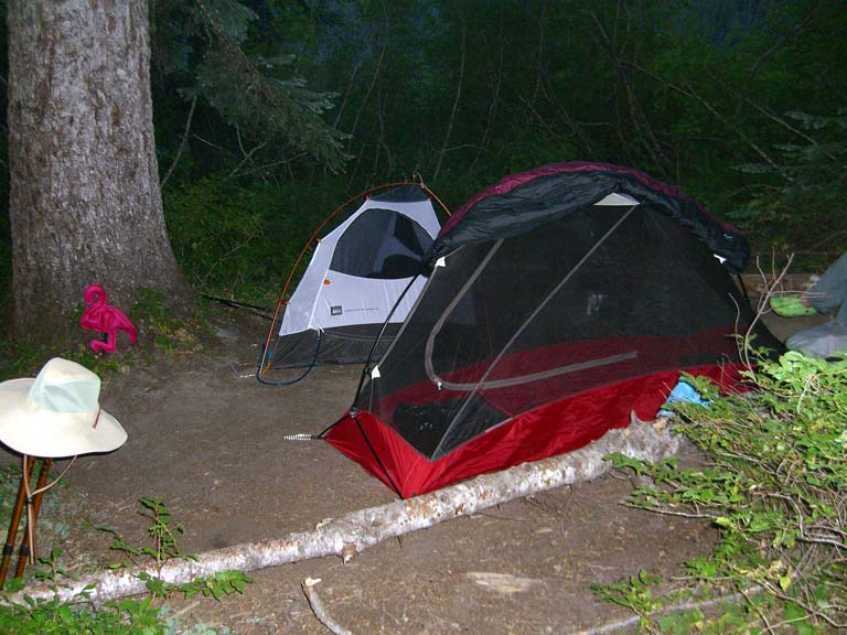
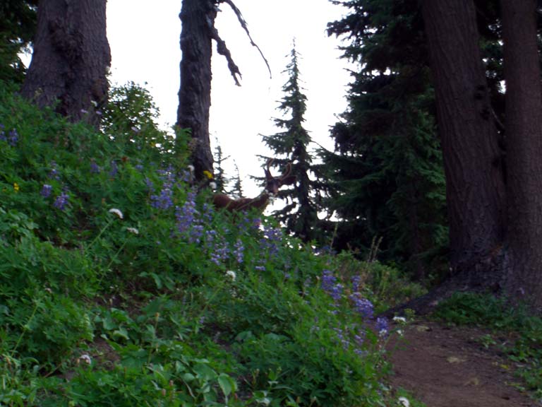
scenery and then crossed Lost Creek and headed to the campsite. The children had begun setting up their site and we choose a site well away from them. With camp set up and dinner et (washed down with some cider I had brought as a surprize!), we headed back to the meadow to take more photos and wait for the sunset. While waiting a PCT thru-hiker came by and we chatted briefly. Shortly later we spied a buck peering around the corner, probably hoping we’d leave so he could go get a drink from the creek. 
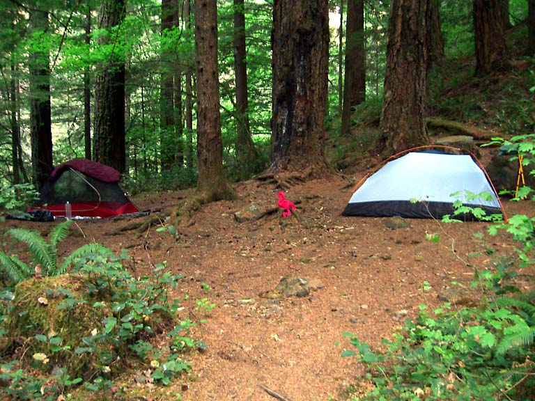
With the light quickly ebbing, we went back to camp. While bear bagging our food, Karen and I learned that Ryan simply uses his food bag as a pillow. It seems Ryan minored in bear wrestling in college and had no need to be afraid. Karen and I had our doubts, and were glad Ryan had picked a camp spot a little ways off, though still uncomfortable close. We crawled into our tents and day one was over.