Day 1: 4.8 + 2.0 miles
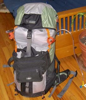
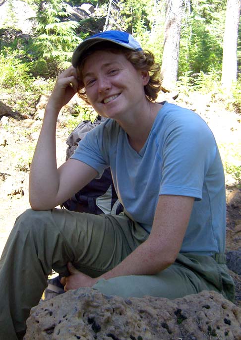
I woke up around 7AM in order to make the trek to the Hollywood Pig Pen. I had spent the night before checking and double-checking my pack to ensure that I had everything I needed (and wanted). The end result was a 35 pound bag (inclusive of 3 liters of water).
I decided to go through the drive-thru at the North Plains McDonald’s for my last “real” meal. It made me think the freeze-dried food in my pack was gourmet. After arriving at Karen’s, I handed over her share of the fuel and her stove and we awaited for the arrival of Chauffeur Wingnut and our limousine which arrived promptly on time with Emily, our entertainment for the drive. Seeing as how there were two new letterboxes on the way up Mount Hood and that we only had a short hiking day planned, we stopped to get those. Once those were found, the only thing left to do before going to the trailhead was using our last real restroom at the Government Camp rest stop. Then, our first tragedy of the trip: the minivan would not start! Fortunately, Henry Winkler happened to wander by, and with a quick bang on the hood, all was well and we headed straight to Barlow Pass. Emily, who until this time had thought we were just out for a day trip, informed us that we were crazy for voluntarily heading into the woods for almost a week. She is probably right.
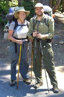
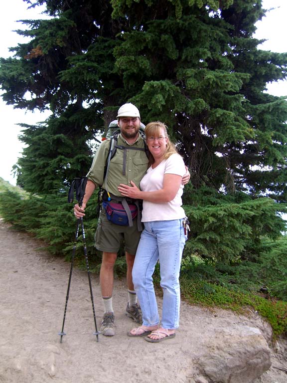
After the obligatory photos, we waved goodbye and there was nothing to do but start walking. We stayed on the Pacific Crest trail for just over a mile before heading down the Palmateer Trail. On the way we met just one day hiker, our first opportunity to look derisively at someone with a tiny day pack. We had not hiked far enough to look at a day pack enviously.
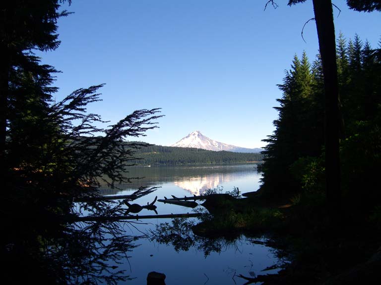
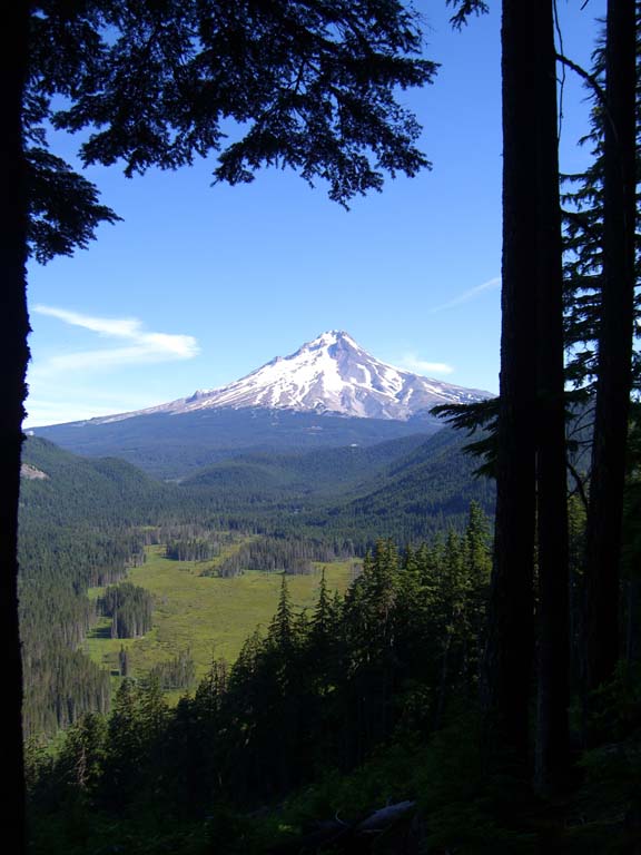
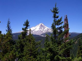
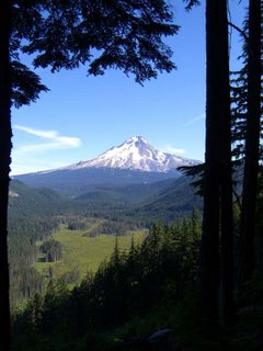
We went up the Palmateer View spur trail to an incredible view of Mount Hood and a perfect
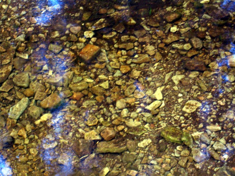
spot for lunch. Our bellies full of jerky and gorp, we continued on our business of seeking out the Twin Lakes. Along the way we got our feet wet crossing a stream and ran into two guys on the trail. We found out that would be our campmates at Lower Twin Lake. They had come from the Frog Lake trailhead and had already set up camp and were doing some day hiking - without maps or even much of a clue as to where the trails around here went. We showed them our maps and gave them advice to check out the Palmateer View and we parted ways. Karen and I quickly discussed whether there would be one or two tents set up when we got to what we would later name Camp Brokeback.
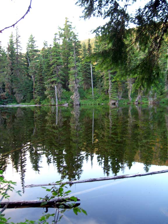
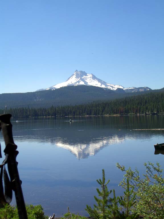
Upper Twin Lake was our first lake on the trail and what a view it provided! A short bit later
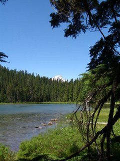
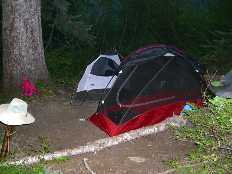
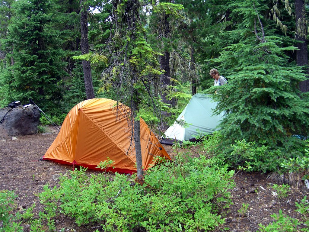
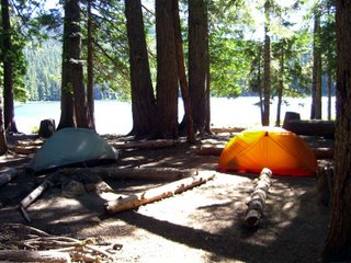
we found Lower Twin Lake and its abundance of good campsites with just a single solitary tent set up. After dawdling a bit we set up camp and headed around the lake looking for Ryan’s letterbox there. The clues had us looking for a beach on the "far side" of the lake. Apparently Ryan couldn’t be bothered with identifying which is near side of the lake. We looked in vain for babes in bikinis and buff boys on a beach, immensely disappointing the both of us. Back at our campsite, we made dinner and discovered our first error in packing: we had both brought way too much food. Stuffed, and with letfovers, we bear bagged the food, an exercise which fortunately had no witnesses. At one point the rock throw bag got stuck in a branch and I needed to pull it down. Being an engineer, I knew that once the bag was released it would rocket down towards us so I accounted for that fact. However, since my last physics class was 15 years ago, I made the calculations with sine where I should have used cosine and instead of being safely out of the way I found myself in the direct line of the projectile. I did manage to mostly evade the rock, getting only a glancing blow to the side of my knee.
Camp duties complete we decided to walk around the lake in the opposite direction in a second attempt to find the letterbox. Alas, Ryan’s clues again failed us, it certainly could not have been our fault! Back at the campsite, the Brokeback Boys had a campfire going, and as it was getting pretty cool, we decided to socialize and steal some of the heat. They were quite friendly - one was a nurses' assistant and the other worked in the Portland Beaver’s laundry room. We discussed backpacking a while. They were just doing an overnight trip and yet somehow their packs weighed 70-80 pounds. We were a little perplexed as to what they had in their packs because they didn’t seem to have any luxuries like camp chairs or televisions. And they were eating MREs (where they got the MREs we didn’t ask and they didn’t tell) so they didn’t even have the weight of a stove and fuel. The night was growing colder and with a 13 mile day scheduled, we said goodnight and hit our tents and down sleeping bags.
Day 2: 13.6 + 1.0 miles
One of the good things about having pets in the house is that you can blame unexplained noises in the middle of the night on them instead of having to search every corner of the house for invisible prowlers. Thus I missed Janis during the night. I wasn’t concerned with prowlers, or even the Brokeback boys. I wasn’t really even afraid of lions, tigers, and bears, at least not directly, but I was concerned with the food and in the woods an active imagination can turn every little noise into a big commotion. It didn’t that me long to get used to it, but it didn’t happen the first night and I didn’t sleep real well. I think the fact I had fully inflated my sleeping pad contributed to the poor quality of my sleep. I made a mental note to just let it self inflate next time.
About 6AM I hear Karen getting up. This surprised me in that I know that she normally doesn’t voluntarily get up before about 3 in the afternoon. As it turns out, nature had provided a wake up call in the form of a chipmunk trying to get into her pack. This was actually a good thing since we had a long day ahead of us. We retrieved the food and Karen had her leftovers while I had oatmeal and white tea. After breakfast and packing camp we recommenced our journey. There was still no sign of life from the Brokeback tent.
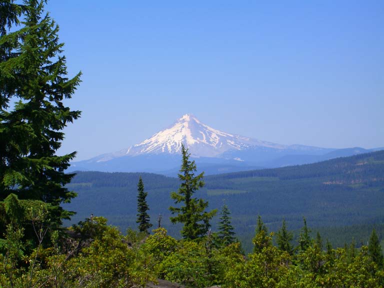
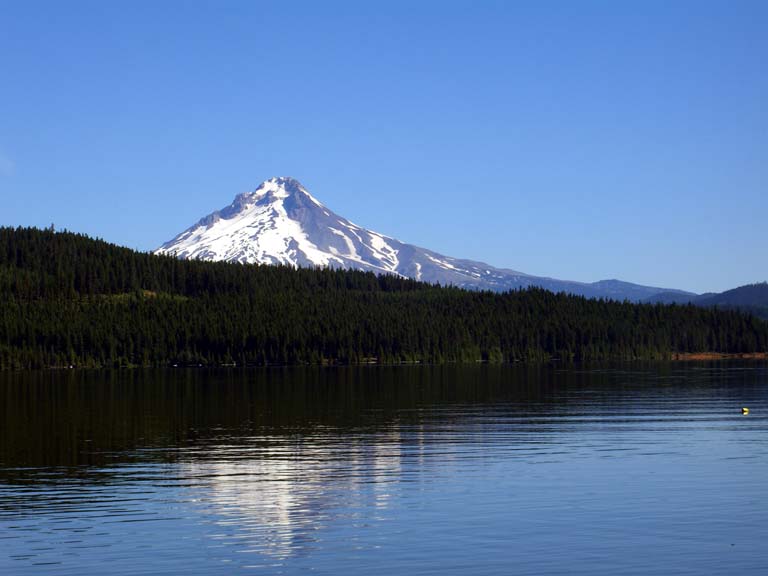
We quickly climbed back up the Twin Lake trail to the PCT which we would stay on for the vast majority of the day. Soon we descended down to Wapinitia Pass and the crossing of highway 26. My schedule was working out well, as I made use of the vault toilet there. A no trowel day for me! Strangely enough, the short day and night in the woods had already made something as mundane as a highway seem like an exotic and scary thing. Fortunately we saw no traffic and had an uneventful crossing. The trail climbed back up and the trail headed southwest just below a ridge. Mother Nature had thoughtfully provided several breaks in the trees with fantastic views of Mount Hood. Not only were the views inspiring, but they afforded us excuses to take rest breaks and confirmed that we were indeed, as planned, hiking away from Mount Hood.
Soon we met our first real backpacker on the trail, another segment hiker. He was coming from Breitenbush and heading up to Mount Hood. We were grateful to hear that the trail should be clear all the way to Olallie and we were able to report that the short bit he had left should be problem free. Soon after we parted ways, Karen discovered that we had provided something else for each other – the trail was now free of spider webs! This didn’t benefit me as our hiking protocol was for Karen to lead as my natural pace is too fast for her, or even me over an extended day. I haven’t yet trained myself to hike a slower pace but I can comfortably follow someone setting a slower pace. This worked out well for me, not just for the spider webs but also I figured that if there was a bear waiting ambush behind a tree, it would eat Karen as while I ran away.
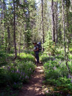
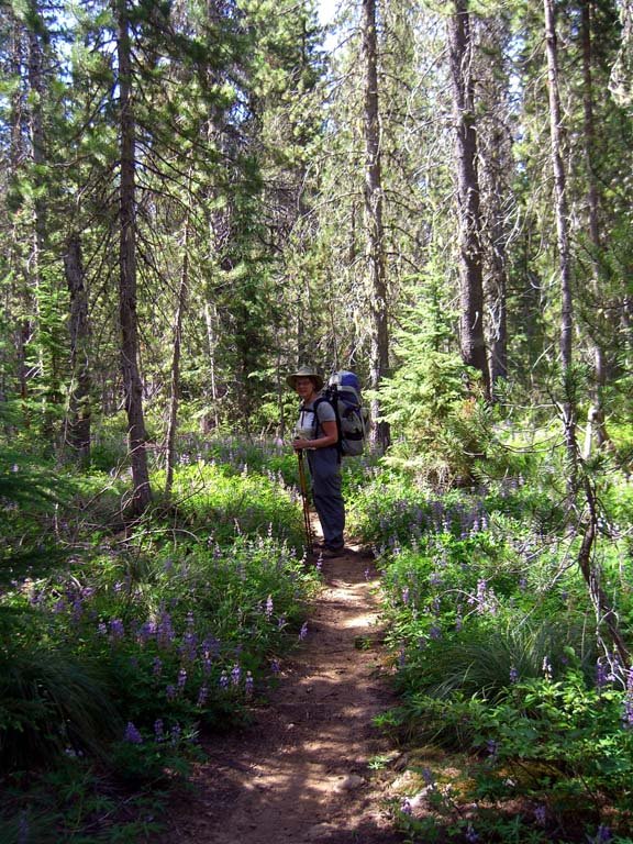
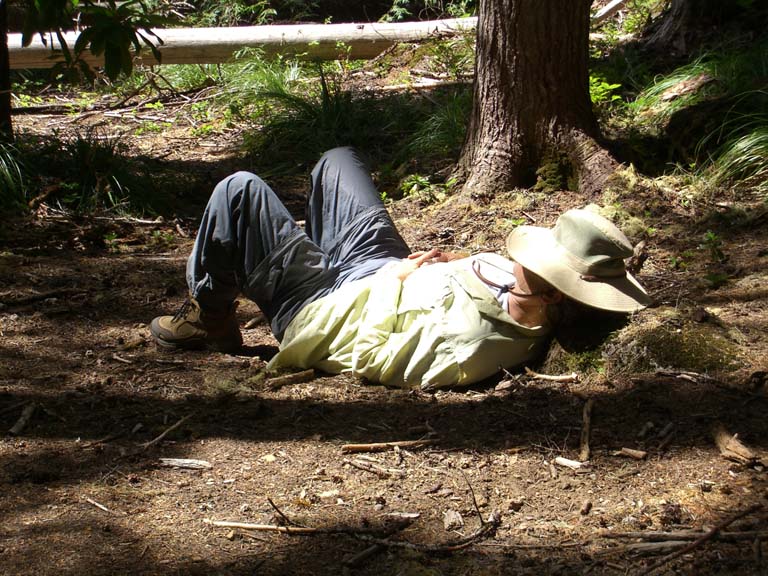
Continuing on we traversed a pretty stretch of trail teeming with blooming lupine. Our ears were greeted with a pleasant humming of the bees amidst the wildflowers. The lupines finally gave away and we found our next landmark – a small campsite with a spring. We thought this was an appropriate place for rest and lunch. Dropping our packs we followed a trail to the spring even though we had no need for water. We ate and relaxed. The permitherin on our clothes faced its first test as there was a minor annoyance of mosquitoes. It seemed to do it job as they stopped bothering us within a few moments. Karen had been lying down quietly but suddendly she was doing something which resembled sign language, though I was at a loss as to whom she may have been conversing.

I eventually had to ask her what she was doing, and she had been composing haiku, the sign language was her way of counting syllables. While she went to write the haiku down, I noticed the babbling of the spring seemed to be much louder than it should have been considering the distance to it. A little investigation revealed that the actual spring was actually just a few feet from where we had been relaxing. What we had found down the trail was just where it stream had come out from under some underbrush. By this time Karen had managed to forget most of the haiku, though she remembered the one line of which she was particularly proud. Unfortunately, upon reciting it, she realized it was six syllables and would have to be discarded.
Back on the trail we descended further as we went southward towards Timothy Lake. We were mostly intent on reaching Little Crater Lake, and there wasn’t much interesting to cause us to pause other than an occasional particularly large old growth tree.
Reaching the spur to Little Crater Lake, we gratefully dropped our packs and went to visit the wonder. After using our bandanas to cool ourselves with the icy cold water
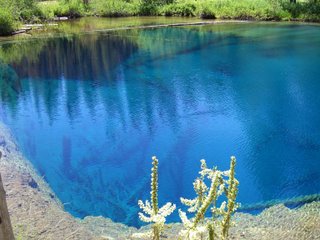
we sat and rested for a while before attempting the letterbox hidden there. While we were resting a family came up and we enthralled them with our depth of knowledge of the lake: the water is about 34 degrees and that it is actually a spring. Had they bothered to read the sign they were leaning on, they could have found this out for themselves. Feeling superior though, I decided to add the tidbit that the rangers had just finished adding the blue food coloring to the lake, something they do each Wednesday afternoon. I hope little Bobby’s essay next year at school on what he did last summer includes that in it.
As the letterbox clues didn’t involved the “far side” of Little Crater Lake, we managed to find the letterbox. It seems that the lake is a fine spot for learning as while Karen was replacing the box, I managed to overhear a little lesson a grandmother was giving her granddaughter. The little girl had asked why you can’t swim in the lake and the surprising answer was that the lake is too small to swim in. Note that Little Crater lake is bigger than most backyard swimming pools so please help me get the word out that all swimming in backyard pools must immediately cease due to the size problem.
With three miles to go, we decided it was time to get on our way and we thus left Little Crater Lake and the PCT for the Timothy Lake trail. Before we left though, we couldn’t resist tanking up on the water and we foolishly carried way more than we needed for a three mile walk to a campsite with water. So with our heavy packs, we trudged down the trail. Soon we came up to a sign with a map of the area. Despite knowing the way, and not needing to use the map, we still took the opportunity to drop our packs. There was a couple there also looking at the map. We chatted with them and discerned that they had canoed across the lake and the husband was trying to figure out how to drive to the nearby campground. He was doing this by alternately looking at the map and the road. It took Karen and I about two seconds to figure the directions, seeing as how there was a road that went pretty much directly from where they launched to the campground. Karen traced the route for him on the map. He looked from the map to the road. I helpfully added that that indeed looks like the way to go. He looked from the map to the road. They may still be standing in front of that map today.
Not to far down the trail we had to step aside to allow some equestrians to pass through. I, and not completely in jest, asked if they would carry our packs for us. A woman derisively responded, “these are not pack animals.” I responded, “Ma’am, I’ve got 27 pounds of Little Crater Lake water, 17 pounds of food, 20 pounds of gear, and that plus my weight is still about 50 pounds short of what you weigh.” She didn’t seem to appreciate that and with a flick of her reins, her horse dutifully left a odoriferous present for us all over the trail and they wandered off.
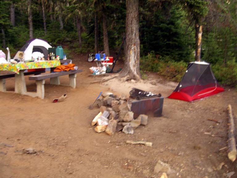
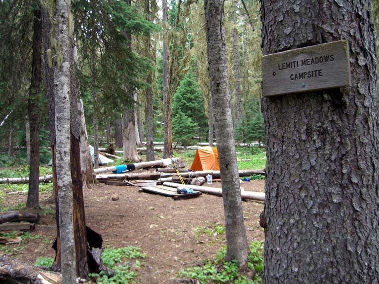
The trail then became hell for us. Oh, it was flat and shaded, but we wanted so badly to be done for the day. We were also getting anxious about finding a campsite at Meditation Point which is a first-come first-served campsite. As it is hike or boat in only I hadn’t anticipated to be a issue in the middle of the week. But we were seeing campsite after campsite pitched in unofficial spots all along the trail. Would Meditation Point be full? Finally we arrived at the trail to the campsite. We headed down the trail and the side trail to the first of five sites had a paper plate with “Reserved, Gary” written on it. Karen and I quickly decided that if the other spots were full, and there was no tent down that trail, that the paper plate would mysteriously disappear. Campsite two though was empty and looked quite nice. We dropped our packs and traded our boots and shoes for flip-flops. It was heaven! We couldn’t really see over to Camp Gary, though we could see a boat tied up down below it. Eventually we set up camp and headed back to check out the rest of the peninsula and a vain attempt to look for a letterbox for which we had lost the clues. While doing so, we found another highly intelligent human specimen who was trying to chop a large living branch off a tree while talking on a cell phone. This despite the numerous signs saying this was illegal and the fact that there was plenty of dead and dry wood on the ground. Eco-babe Karen admonished the woman and shortly later we saw her carrying a nice piece of dead wood she had found on the ground. She didn’t say so, but I’m sure she was grateful that Karen saved her a good fifteen minutes of unnecessary work.
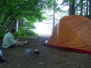
We went back to our site and while Karen was tending the stove for the meal we would sensibly share that night, I snuck over to Camp Gary and stole a few beers. Dinner was great – thanks Gary and Mary Jane! – and we retired to our tents. I was tired, but didn’t feel sleepy and expected to just lie a while and meditate, after all it was Meditation Point. The next thing I knew, I woke to sounds from Camp Gary and my watch told me I had been sleeping for an hour and a half. Camp Gary seemed to be having a nice party, not objectionably loud, but I could hear the goings on. Soon I heard someone say, “Hey, there are three more Coors Lights!” I guess I could have taken a few more and they would have never missed them.
 free! We had yet to find Ryan but with such a good spot, we made camp. I changed into my Crocs practically before I even took my pack off which felt even better than it normally does. Karen kept her boots on, as we were planning to walk the 3.4 miles around the lake to go to the store and to hunt a letterbox and possibly find Ryan. But my feet were done with my shoes for the day and I kept the crocs on. We hit the trail and stopped at the lake which was quite refreshing and then headed to the store. I got ice cream and a beer, which actually goes together much better than you’d think. We watched the idiots who were renting the apartment over the store. One guy was dousing a lit grill with lighter fluid and then he piled about 30 potatoes in a pyramid on the grate which was raised as high as it could go above the fire. I suspect some of those potatoes are still raw.
 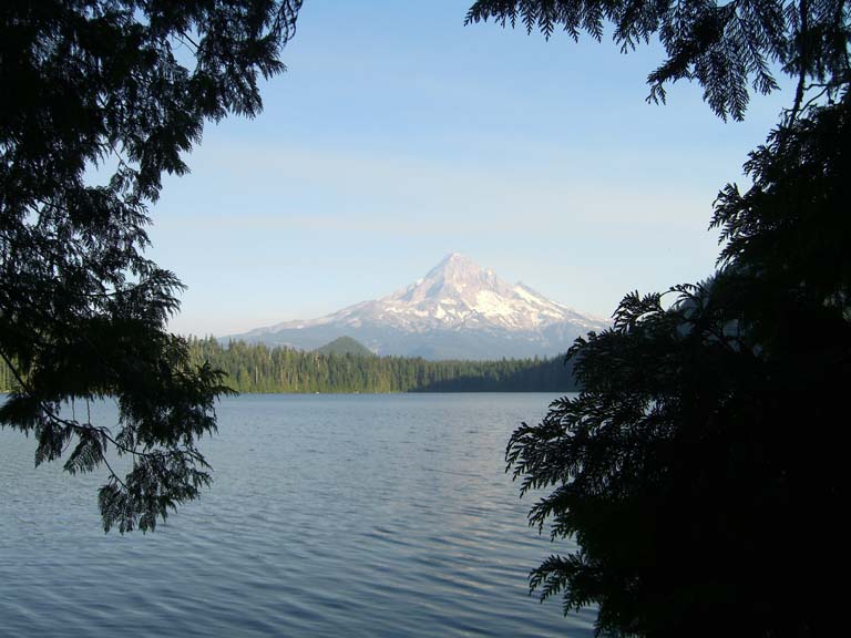 the mountain. We headed on and found the letterbox and returned to camp. Since the lake was the first water we had met that wasn’t ice cold, we took the opportunity to bathe and do some laundry. We stayed pretty modest though that didn’t stop a bunch of high school kids from spying on us. I’m not sure who – or what – they were hoping to see, but I suspect they went away disappointed.